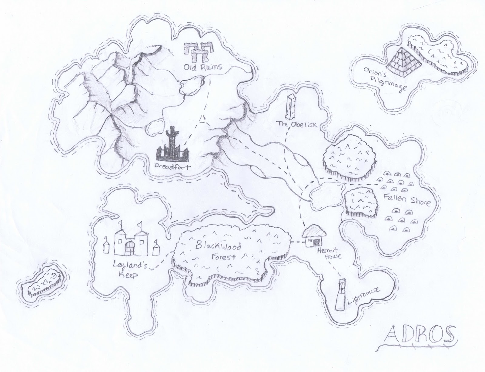
Wednesday, September 30, 2015
Assignment 5 - Fantasy Map
Wednesday, September 16, 2015
Assignment 3 - Handwritten Direction and Maps


For this assignment, I stood at the Crossroads and asked 5 people to give me directions to the library with either a hand drawn map or written list of instructions. After receiving the instructions or map, I then attempted to get to the library only using those instructions. I found that the maps were incredibly easier to follow than the written instructions. In fact, while I made it to the library every time by following the maps, I got lost every single time following the handwritten instructions.
One of the problem with the handwritten instructions, is that they required knowledge about the names of different buildings on campus which I wouldn't necessarily know if I was someone new on campus looking for directions. While the maps used building names as well, you could use relative positioning of the buildings to figure out which ones they were. Another problem I noticed with handwritten instructions is that people's memory of how things look don't necessarily match up with reality. For example, one person told me to follow a path until the ground changed color, remembering that the path in front of the library is a different color than the rest of the path. What they didn't remember is that the path actually changes color four different times before the library.
In conclusion, if someone asks me for directions in the future I will definitely make them a map!
Wednesday, September 9, 2015
Assignment 2 - Campus Art Map

For this assignment I began by trying to think of symbolism that was frequently used on campus. The first thing that came to mind were the statues in some of the quads. Specifically, the pie statue, the infinity statue, and the sundial. In the center of campus, where the Eastman building would be, I drew the all seeing eye, because this is where a large amount of campus administration works. In general, I decided to draw the campus as an island to reflect the isolated nature of the campus in real life.
Assignment 1 - Hometown Map

For this assignment I was tasked with making a map of my hometown of Albany, New York, from memory. Throughout the map making process, I discovered that I think about Albany in terms of memorable areas, which led me to highlight several different regions on the map. One of the more interesting regions is the green region labeled "My Neighborhood". It may seem weird that someone would label a 1.5 square mile area as their neighborhood, but this is the area where I walked to school every day, where my closest friends live, and where I have distinct memories of riding my bike throughout the hilly streets. Another discovery I made when mapping this region was that the significant points of the region tend to line its borders even though I drew the region's borders before placing the significant points on the map. This tells me that I must have been subconsciously thinking about the significant points as I was drawing the borders.
Subscribe to:
Comments (Atom)